An overview of the influence of the regolith on mineral exploration sampling media, north-east Queensland
Simon D Beams, in The State of the Regolith. Geological Society of Australia Special Publication 20, 7-22.


Simon D Beams, in The State of the Regolith. Geological Society of Australia Special Publication 20, 7-22.
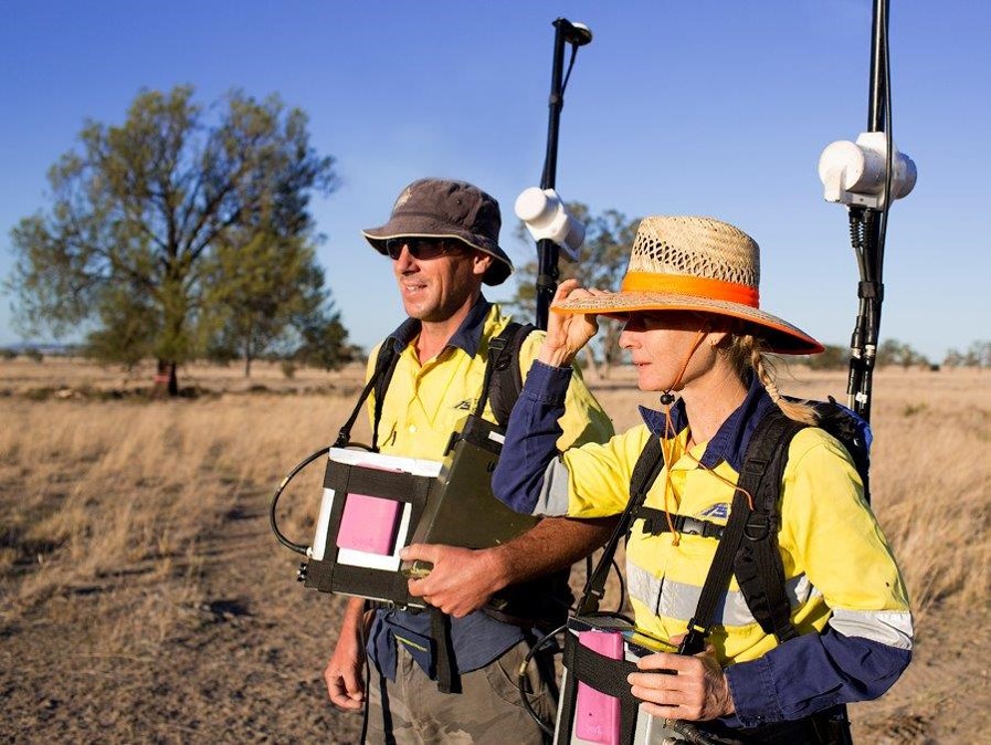
Mineral explorationists have responded to the variability of the regolith in north-east Queensland by successfully utilising different geochemical sampling media. Exploration companies have collected the vast majority of the estimated 300 000 surface samples from erosional regimes which represent 60% or 15 000 km2 of the surface area. Sampling media such as stream sediment, soil and rock chip extend over a large portion of these outcropping Palaeozoic basement areas of the Ravenswood Block and Drummond Basin.
Techniques that have been particularly effective in locating outcropping polymetallic massive sulphides, epithermal and mesothermal vein- and breccia-related gold mineralisation, are: fine fraction stream sediments (e.g.-80 mesh); bulk cyanide leach (BCL) stream sediments; fine fraction soil sampling (e.g. -80 mesh); gossan and rock chip sampling of surface outcrop and proximal float.
Areas of transported overburden and relict land surfaces tend to mask the surface geochemical response. Here subsurface methods such as bedrock drilling have been the preferred sampling medium. Interpretation of the whole of the drilled section, including analysis of secondary dispersion haloes within the regolith profile, has led to discoveries of massive sulphide and epithermal vein mineralisation.
In recent years more innovative sampling such as mixed media lag has shown that it is possible to locate blind mineralisation by surface sampling in complex depositional and relict regimes. Case histories are presented which illustrate how the mineral industry moves forward in Australia by taking advantage of the vast resource of historical exploration company data. Recently these data have been made digitally accessible in the public domain.
Assimilation of historical exploration data, together with a greater understanding of the impact of landscape evolution and the regolith, will lead to the development of innovative sampling and analytical techniques which will undoubtedly result in further discoveries.
It is only in relatively recent times that regolith has become a ‘buzz-word’ in mineral exploration. However, explorers in north-east Queensland have certainly been aware of the impact of the regolith on exploration geochemistry ever since the modern era exploration began in the late 1960s. In the intervening period, exploration geochemistry has played a key role in the grassroots discovery of several mineral deposits, and has significantly assisted the evaluation of many others. Mineral exploration companies have utilised geochemical techniques such as stream sediment, soil and rock chip sampling on a regional scale, to screen outcropping bedrock. Complementary to data gathered in these areas of outcrop, bedrock drilling has provided a geochemical data set in regions of transported cover.
Utilising practical examples from the wealth of exploration industry data, this paper presents an overview of the influence that the regolith and landform development has on the design and implementation of geochemical regional exploration programs. North East Queensland, along with most of Eastern Australia, is characterised by complex landscape development and weathering history. Selected papers on the topic are: Grimes (1979, 1980, 1993); Henderson and Nind(1994); Pain (1994); Rivers eta/. (1996). Beams and Jenkins (1995) recently reviewed the impact of the regolith on geochemical exploration procedures. This paper will borrow heavily from that source, updating with more current data. The lead time involved before proprietary information arrives in the public domain means that it is not possible to cover all of the innovative sampling media and geochemical techniques such as partial digests which are currently being utilised.
The depositional, erosional and relict regolith regimes of North East Queensland are shown in Figure 1, based on current published regional 1: 250 000 and 1: I 00 000 geological maps.
Recent uplift has affected the region. In areas of high relief such as east of the Pacific coastal ranges, which occupy the north east portion of Figure 1, weathering products can be quickly stripped off. Active erosion, which is currently occurring in this region, probably extends back into the Tertiary, with accompanying sediment deposition and inundation occurring along the coastal strip.

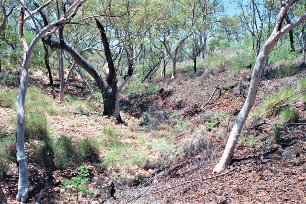
West of the coastal ranges, a more complex weathering history is preserved. Several peneplained land surfaces indicate periods of long-lived weathering, interspersed with erosion and deposition of fluviatile, colluvial and lacustrine sediments.
The variability of the effects of weathering is a reflection of the amount of relief. Resistant topographic highs emerge from the peneplains and are characterised by shallow weathering and skeletal soils. Fresh sulphide can be common in surface exposures. In contrast, deep weathering can be present below the relict peneplained land surface, although even here, total depth of weathering is variable. Inverted drainage often imparts a complexity to the weathering profile. The relict land surfaces themselves are characterised by duricrust and ferricrete, which cap Tertiary sediments or weathered Lower to Upper Paleozoic bedrock.
The full weathering profile can have ferricrete, mottled and pallid zones and may extend into the bedrock beneath. Henderson and Nind (1994) regard it as typical lateritic regolith, thought to be developed under a regime of fluctuating water table and warm climate.
There are two prominent land forms:
In the latter instances, cover sediments are primarily channel fill deposits which have smoothed out many of the irregularities in the Tertiary and Quaternary palaeo-surfaces. Grimes (1980; pers. comm. 1992) broadly identified the older land surface and underlying sediments, represented by the Featherby Land Surface and the Southern Cross and Suttor Formations, as Early to Mid Tertiary.
The younger depositional regime is represented by the Late Tertiary to Early Quaternary Campaspe Formation sediments and possible correlatives, e.g. the Sellheim Formation.
In semi-arid tropical North East Queensland, as elsewhere, the regolith influences what type of geochemical exploration procedures are adopted. Surface geochemical techniques developed for locating outcropping mineralisation prevail in erosional regimes: areas where bedrock is exposed, depth of weathering is shallow and outcrop is good. Extensive programs of bedrock geochemical and drilling have occurred over prospective depositional regimes of transported overburden. These relationships between regolith and sampling media have been determined by reference to the enormous resource of exploration data collected by the industry. To date, Terra Search has assembled from exploration company reports a total digital, GIS compatible, data set of 200 000 surface samples and 45 000 bedrock geochemical samples for this region. [Ed. note. Compiled sampling correct as of 1998]. It is estimated that 70% of available data has been captured in this manner. Figure 1 illustrates the relationship between surface stream sediment samples and regolith regime. Sample density is high in erosional regimes developed on Palaeozoic Basement. The Ravenswood Block in the north of the map and the outcropping Drummond Basin region in the centre of the map are examples of prospective gold and base metal sub-provinces extensively screened by surface stream sediment sampling. South and west of the erosional areas only scattered sampling is evident in the depositional regimes of Tertiary and Quaternary transported overburden. Much of this latter sampling is related to small inliers of Palaeozoic Basement or larger streams draining erosional regimes.
The relict land surfaces of ferruginous duricrust have only been sparsely sampled in the past. These are flat mesas where drainage is ill defined. The relict surfaces often represent inverted topography, capping Tertiary sediment. These have thus been generally interpreted as delineating depositional regimes. This is not always the case and relict lateritised basement is often present e.g. Rivers eta/. (1996). If this is more widely established, it is anticipated that denser sampling of these areas will occur in the future.
Widely used techniques in this category include rock chip sampling, prospecting for gossan and vein outcrop/ subcrop, -80 mesh grid soil sampling, stream sediment sampling (-80 mesh, pan concentrate and Bulk Cyanide Leach extractable gold and other metals (BCL)), ridge and spur sampling and BCL soil sampling. Examples of outcropping mineralisation discovered in this fashion are: Au vein/ deposits at Pajingo, Wirralie, Belyando, Yandan, and massive base metal sulphide deposits at Thalanga, Balcooma and Magpie. Some previously-worked deposits also fall into this category, in the sense that, if they had been unknown, surface techniques would undoubtedly have led to their discovery. Large-scale Au breccia ore bodies at Kidston and Mt Leyshon, Au vein deposits at Ravenswood, Charters Towers, Disraeli and Mt Coolon, and massive sulphide deposits at Liontown, are all examples.
Sieved stream sediment sampling (mainly -80 mesh) has covered the outcropping areas of the Cambro Ordovician Mt Windsor Volcanic Belt, which hosts several massive sulphide deposits (see Berry et al. 1992; Morrison & Beams 1995). Using Pb as an example, Figure 2 illustrates the effectiveness of these programs in locating outcropping and subcropping mineralisation such as Liontown and Handcuff. Several large-scale (uneconomic to date) alteration systems have also been located, e.g. Gidgee and Trooper Creek. Almost all the samples in this population have been sieved in the field to -80 mesh (180 micron) from dry active sediments, then submitted to commercial laboratories, where a solution has been prepared utilising a perchloric acid digest at 220°C and analysis for Cu Pb Zn by Atomic Absorption Spectrophotometry (AAS). Detection limits are generally Cu (2 ppm) Pb (5 ppm) Zn (2 ppm). The Figure 2 dataset has built up since the late 1960s and represents more than five different companies’ exploration programs: Mt lsa Mines (Russi 1967); Jododex (1974); Esso Australia (Fraser 1976); Penarroya (Becerra 1982); Pan Australia Mining (Beams 1990).


Regional soil programs have also been effective in delineating zones of outcropping/ subcropping mineralisation. Figure 3 is an example from the same area of the Ravenswood Block as Figure 2, showing well defined Pb anomalies at Handcuff/Reward, Liontown, Trooper Creek, Gidgee within the erosional regime developed on the outcropping Mt Windsor Volcanic Belt. Breccia hosted Permian gold mineralisation at Mt Leyshon is also delineated. Sample media is -80 mesh sieved A/B horizon soils generally collected with a soil pick from depths of 5 to 10 em. The soil data have been assembled from various companies, primarily Esso Australia Ltd (Castle 1982; Beams 1984), Mt Leyshon Gold Mines (Beams 1990; Orr 1995) and Pancontinental/RGC Exploration. Almost all analytical procedures involved AAS with a perchloric acid digest at 220°C. The Highway and Handcuff anomalies occur over areas of 200 m x 200 m and 500 m x 200 m respec tively, where Pb + Zn are greater than 500 ppm, Cu is greater than 200 ppm. Deeper drilling of these zones has resulted in massive or semi-massive sulphide discoveries.
BCL stream sediment sampling has proved a very sensitive and successful technique for locating various styles of gold mineralisation in the erosional and mixed erosional, depositional and relict regimes in North East Queensland. Figure 4 illustrates the effectiveness of the method; survey details are presented in Table I. The method has been used very effectively in the erosional areas of the Drummond Basin e.g. Wirralie and Pajingo, where highly resistant, fine-grained siliceous materials are the principal weathering products of exposure and weathering of epithermal style veins/ stockworks. The generally fine-grained nature of the gold contained in these systems is the main reason that gold prospectors in the last century, using traditional methods such as panning, did not discover the Drummond Basin deposits. BCL sampling media for these particular surveys consisted of 4-6 kg of dry active stream sediment passed through a coarse sieve at the sample site to remove pebbles and boulders. Samples were taken to avoid charcoal patches in the drainage channel. Trap sites likely to concentrate gold are avoided in most surveys. At Pajingo, Battle Mountain sampled ‘semi trap’ sites, e.g. point bar deposits within streams. The analytical procedure depends on the laboratory and method.


The method employed at Australian Laboratory Services (ALS) is PM216, which involves an active 24- hour leach of a cyanide solution/ sample mixture continuously agitated in a revolving plastic container. Gold is absorbed onto surface active carbon which is contained in a leach pad and remains in the vessel during the entire leaching phase. Upon completion of the leaching process, the carbon pads are withdrawn from the solution, washed and dried and the activated carbon is ashed and digested prior to analysis by AAS. Detection limit for this highly sensitive partial extrac tion method is 0.05 ppb Au.
With Australian Assay Laboratories, Townsville (AAL) a 24-hour bottle roll in alkaline dilute cyanide solution is employed. An aliquot is taken and gold extracted into organic solvent DIBK for reading by carbon rod or AAS. ACM utilised their own laboratories and patented zinc collection method on the cyanide solution.
The survey at Mt Leyshon (Figure 4A) was conducted before modem mining commenced. (Orr 1995). BCL data from drainages greater than 1 to 2 square kilometres, across the Ravenswood Block, show that Au values greater than 1 ppb are regionally anomalous. In the Puddler Creek area surrounding Mt Leyshon anomalous drainages can be usually traced back to an outcropping Au source (Beams 1990). BCL Au values from Figure 4A show all the streams draining the Mt Leyshon Complex yield strongly anomalous samples (> 5 ppb Au). Extremely high BCL values in the 70 to 120 ppb Au attest to the regional significance of the Mt Leyshon anomaly.
Although spoil from historical workings may have enhanced some of the drainages, a Mt Leyshon type mineralising system in an erosional regolith regime would have been clearly picked up in a regional BCL stream survey, even if no historical workings were present.
Wirralie (Figure 4B) was discovered by following up a regional BCL stream sediment anomaly (Fellows & Hammond 1988, 1990; Seed 1995). The mineralised outcrop occurred as a small rise above a dominantly depositional regime. The discovery history was detailed by Seed (1995): Previous explorers had not detected any anomalism in -80# stream sediment samples in the general area (Mike Fellows pers. comm. 1987). Two regional BLEG samples from Sugarbag Creek, which drains the Wirralie deposit, returned highly anomalous values: 6.79 ppb and 8.96 ppb Au. Follow-up BLEG samples nearer to the deposit gave higher results: 16.8 ppb and 42.8 ppb Au.
Float analysis along the anomalous streams led to semi-detailed rock chip sampling (30 samples) over the obvious outcropping alteration and mineralisation; the Wirralie pits were subsequently centred on these outcrops. Results were encouraging, with Au values up to 7.14 ppm and anomalous pathfinder elements such as Hg (up to 3370 ppb), As (up to 1010 ppm) and Sb (up to 115 ppm). Grid-based mapping and rock chip sampling at 1:1000 outlined the area of interest. The first drill hole intersected 55m at 2.57 g/t Au. There does not appear to be any significant depletion or enrichment of gold in the near-surface environment at the Wirralie deposit, however no detailed research has been conducted to evaluate any secondary redistribution.
The Pajingo area (Figure 4C) provides an excellent case history of the effectiveness of modern exploration techniques in locating small high-grade vein systems in an area having a complex landscape evolution and regolith development (see Porter 1990; Beams & Jenkins 1995). Relict lateritised duricrust are developed in places both on Tertiary sediments and a variably weathered Permo-Carboniferous volcanoI sedimentary sequence. Although Pajingo was discovered by geologi cal prospecting, there is a strong, although regionally restricted geochemical drainage signature. Using Battle Mountain Australia data, Cameron(1991) found that BCL, panned concentrate stream sediment, and rock chip float all successfully located the main mineralisation at Pajingo. BCL sampling shows the entire area to be anomalous. Panned concentrates were much better at targeting individual prospects. Rock chip sampling of float, like panned concentrate sampling, also clearly located mineralisation within the overall area (Beams & Jenkins 1995).
Plateau (Figure 4D) is a high-sulphide vein system within Cambro-Ordovician andesites, intruded by Permo-Carboniferous breccia, 100 km SE of Charters Towers. Surface exposure of the mineralisation is represented by gossanous and manganiferous veins and stockworks. Relict lateritised duricrusts overlie weathered andesitic bedrock and Tertiary sediments. A well defined dispersion trail of gold in BCL streams can be followed into the surrounding depositional regime. Anomalous values of 2-4 ppb Au occur 1-2 km from the prospect. Samples upstream within 20 500 m of outcropping mineralisation returned values up to 265 ppb Au (Magner 1989). Strong Cu Pb Zn anomalies against background delineated the Plateau Prospect in -80 mesh stream sediment sampling (Becerra 1982).
Chip sampling of outcrop, subcrop and float in the erosional regimes is a very effective technique in locating and evaluating surface mineralisation in north east Queensland. As discussed above, rock chip sampling can be also effective in evaluating geological anomalies in complex regolith regimes e.g. Wirralie and Pajingo. Figure 5 is an example of sampling over an erosional regime from the Mt Leyshon area south of Charters Towers. There are many outcropping vein systems in the area, along with breccia-hosted gold mineralisation at Mt Leyshon and Seventy Mile Mount. At each of the sample sites, 1-2 kg of rock chips have been collected with a geological hammer, usually selected from an approximately 1 square metre area. These samples have been submitted to commercial laboratories where they have been crushed, split and ground before generally 50 g fire assay analysis for gold and AAS or ICP (Induced Coupled Plasma Emission Spectroscopy) analysis for base metals. Rock chip sampling clearly identifies the gold bearing vein and breccia systems in the district (Figure 5).


In sub outcropping/blind deposits the top of significant mineralisation is sub-surface, although there may be surface signs of hydrothermal activity such as outcropping alteration and favourable host stratigraphy, or weak mineralisation. Epithermal Au deposits such as Twin Hills, Lone Sister and Glen Eva and massive sulphide deposits such as Handcuff, Highway and Reward are all blind deposits discovered by sampling of surface or near surface media e.g. sieved stream sediments and soils, mixed media LAG, rock chip and trench, RAB and shallow percussion drilling chips.
Concealed deposits occur buried under transported cover which overlies a large portion of North East Queensland. Exploration to date has involved obtaining sub-surface information through RAB and shallow percussion drilling. Figure 6 shows the distribution of bedrock geochemical drilling in relation to regolith regime for the same area of the Seventy Mile Range Group as Figures 2 and 3. Best downhole results for Pb in ppm are plotted. Interpretation of secondary dispersion haloes in transported overburden and underlying bedrock led to discoveries of massive sulphide base metal mineralisation at Waterloo and Reward; mineralised alteration systems at Liontown East and Trooper Creek and extensions of the Thalanga mineralisation under cover at Thalanga East, 40 km west of Waterloo.
Figures 7 to 10 illustrate the sampling media whichhave played a key role in the discovery of some blind deposits in North East Queensland.
The exploration history, geology and geochemistry of the polymetallic Reward deposit are discussed by Beams eta/. (1989, 1990). Beams and Dronseika (1995)
discussed the geochemical implications of the regolith. The next section is partly transcribed from that reference:
In the Reward/Highway area, the volcanic host sequence is completely oxidised to vertical depths in excess of 100m. This contrasts with the Handcuff area to the north east where depth of oxidation is approximately 10 to 20 m. Acid groundwaters generated by the large massive pyrite bodies together with the current exposure level being close to the deeply weathered pre-Tertiary land surface, could be responsible for the very deep level of oxidation.

Figure 7 is a composite section through the Reward and Highway pipes showing the surface Pb values obtained by soil sampling together with sub-surface sampling by RAB bedrock drilling. Elevated Pb and Cu values in the 400 to 800 ppm and 200 to 300 ppm range respectively were present in soil sampling of the outcrop areas. The soil values dropped off rapidly to very low levels where a cover sequence of coarse boulder conglomerate, ferruginous clay-rich grits, and silts, lap onto the grid eastern side of the Reward deposit. Although the Reward pipe is blind, a geochemical signature is present in the overlying rocks, the recognition of which led to its discovery. Elevated values of Au (0.2- 0.5 ppm), Cu (300-2200 ppm), Pb (200-1200 ppm), Zn (200-1400 ppm) and Ba (O.l-1.4%) were returned from depths of 10-80 m in RAB drillholes which penetrated into both the outcropping and deeply covered weathered volcanics (Beams 1984). Au anomalism in the 100-200 ppb range was also detected as secondary dispersion in the regolith sediments immediately above the Reward pipe. Trenching of silica-altered, jarosite-boxworked and barite veined outcropping rhyolite in the same area returned Au values up to 5 mat 0.5 ppm Au.
A long-lived weathering regime operated on the massive and semi-massive sulphide bodies at Reward and Highway resulting in strong gossan development, leaching and supergene mineralisation. The Highway pipe has a gossanous breccia developed at the present day land surface, whereas the gossan development above the Reward pipe is subsurface. Leaching of copper and silver down through the weathering profile produced supergene mineralisation. The base of complete oxidation delineates a sharp boundary where copper is present in the 200-2000 ppm range in the oxide zone and extremely enriched in the 8 to 40% Cu range in the supergene zone. Although silver and gold do not mirror copper, there is evidence of supergene development. High silver values in the 50 to 80 ppm Ag are present in a contact zone at the base of complete oxidation. High Au, on the other hand, can occur in the oxide-baritic breccia zones at Highway and Reward. Gold is also enriched in the contact zone and is present in moderate levels (0.5-1 g/t Au) in the supergene and primary massive sulphide zones. The sharpness of the base of complete oxidation, which is well below the current water table depth, suggests a long-lived oxidation front which operated when there was a lower, stable water table regime relative to the present day.
")
The Thalanga deposit was discovered in 1978 by rock chip sampling of an outcropping gossan (Gregory et al.1990; Hermann 1995). Geologists from the company involved in the Thalanga discovery, Penarroya Australia Pty Ltd, then began turning their attention to large areas of the Mt Windsor Volcanic Belt under the cover of transported overburden of the Campaspe Formation and other units (Hartley & Alston 1995). At the time, the general approach to exploration under cover was drilling of rotary air blast (RAB) blade holes through any transported material, then only sampling bedrock. This approach could only he successful if a relatively small geochemical target was intersected, which represented palaeo-outcrop or primary dispersion in an alteration zone within the bedrock. Interpretation of the geological and geochemical results of the RAB drilling programs at Thalanga led to the conclusion that a larger geochemical target was present. Fragments of gossan and boxworked volcanics were identified during logging of RAB chips which were considered to result from mechanical dispersion of mineralised outcrop at the buried land surface.
Chemical dispersion into the overlying transported sediments would provide a potentially even larger exploration target. Sampling of the full geochemical profile in regional bedrock drilling programs resulted in exploration success, with the discovery in the early 1980s of the Thalanga East and Waterloo polymetallic massive sulphide deposits buried under 20-30 m of transported overburden (Hartley & Alston 1995).
Figure 8 is a simplified geological cross-section of Thalanga East showing the relationship of exploration RAB holes to the transported overburden and bedrock. These geological components are identified in the Regolith Profile as Depositional Sediments and Saprock. Geochemical dispersion in the regolith produced mushroom-shaped anomalies in section and plan. Deeper diamond drill testing of these anomalies led to the discovery of buried massive sulphide mineralisation. The Waterloo deposit 40 km west of Thalanga (Figures 1 and 6) was discovered after a similar exploration case history (Hartley & Alston 1995).
")
Mixed media lag sampling was instrumental in the discovery of blind epithermal style gold mineralisation in an area of poorly outcropping basement rocks and transported overburden (Alston et al. 1996). Glen Eva is located 20 km E of Mt Coolon (Figures 1 and 9). Mineralisation is hosted by volcanics tuffs and sediments of probable Carboniferous age.
Follow-up of soil anomalies in the erosional remnants of bedrock at the Eastern Siliceous Zone led to the drilling by Dominion Mining Ltd of some encouraging but discontinuous mineralisation. Alston et al. (1996) discussed the subsequent work program and results as follows:
A regional lag program was designed to cover the area between the ‘Eastern Siliceous Zone’ and ‘Hill 273 ‘. After orientation sampling it was decided to collect 1 kg of+1 mm -5 mm surface rock material on 400m centres. The lag material collected was a composite of all surface rock fragments and pisolites over an area of 50-100m2 . These were analysed for Au by low-detection fire assay (1 ppb) and Cu, Pb, Zn, As and Sb by aqua regia digest, AAS finish. Only areas of obvious transported alluvium were excluded from the survey. Areas of known Tertiary sediments were included in the survey.
The results of the lag program confirmed and extended the Au anomalism at the Eastern Siliceous Zone, with values up to 40 ppb Au. A strong As-Sb anomaly was outlined over Hill 273, with values up to 1100 ppm As and 95 ppm Sb (Au <5 ppb). Deeper drill testing of these anomalies led to the discovery of epithermal quartz vein mineralisation at about 60 m vertical.
The conclusions of Alston et al. (1996) concerning sampling media in depositional/ erosional regolith regime surrounding Glen Eva are:
")
Current and future exploration will be directed more towards covered areas. Techniques that can exploit surface or near-surface sampling media will greatly enhance the cost-effectiveness of exploration. In the recent past, North Queensland explorers have adopted a pragmatic approach to geochemical sampling. If a technique and media such as BCL stream sediment sampling leads to a discovery, it is rapidly implemented across the region.
More effort will be put into establishing which particular position in a regolith profile gives the best geochemical response and which zones can give misleading signals either as geochemical dropout/leached zones or alternatively zones of spurious enrichment. Future discoveries will undoubtedly result from a utilisation of well-tested geochemical methods in combination with innovative geochemistry (e.g. partial digest) and sampling media (e.g. lag, laterite media,ferruginous accumulations) together with a greater understanding of landscape evolution and the weather ing environment.
All the data and case histories presented in this paper have been collected by private exploration companies. Their contribution to the understanding of geochemical sampling and the regolith is gratefully acknowledged. In particular Aberfoyle Resources, Battle Mountain Australia, City Resources Limited, Dominion Mining Limited, Esso Australia Limited, Normandy Exploration Australia, RGC Exploration, Ross Mining Limited and Terra Search Pty Ltd have all assisted over the last few years by releasing exploration data. Consultant geologists Tony Alston and John Hartley both kindly provided sections from previous publications.
ALSTON T., HEWITT D. & SHEPHERD A. 1996. Discovery of epithermal gold under cover at Glen Eva, North Queensland. In: Recent Gold Discoveries in North Queensland. Australasian Institute of Mining and Metallurgy Nth Qld Branch One-Day Seminar, II October 1996.
BEAMS S.D. 1984. Mt Windsor ATP3380. Six monthly report for period ending 17/12/84. Esso Australia Ltd. Unpublished open file report CR# 13181 to Queensland Mines Department.
BEAMS S. D. 1990. Authority to Prospect 4229M, Puddler Creek. Partial relinquishment report for sub-blocks dropped 23/2/90. Terra Search Pty Ltd for Pan Australian Mining Ltd. Unpublished open file report CR# 21978 to Queensland Mines Department.
BEAMS S. D. & JENKINS D. R. 1995. Regional exploration geochemistry and the regolith of Northeast Queensland. In: Beams S. D. ed. Mineral deposits of Northeast Queensland: Geology and Geochemistry, pp. 33-53. EGRU Contribution 52, James Cook University.
BEAMS S. D., LAING W. P. & O’NEILL D. M. 1989. The exploration history and geology of the polymetallic Reward deposit, Mt Windsor volcanic belt, North Queensland. North Queensland Gold ’89 Conference, Townsville, Queensland, Proceedings, Aprill989, 95–102.
BEAMS S. D., LAURIE J. P. & O’NEILL D. M. 1990. Reward polymetallic sulphide deposit. In: Hughes F. E. ed. Geology of the Mineral Deposits of Australia and Papua New Guinea, pp. 1539-1543. Australasian Institute of Mining and Metallurgy, Melbourne.
BEAMS S. D. & DRONSEIKA E. V. 1995. Exploration history, geology and geochemistry of the polymetallic Reward & Highway deposits, Mt Windsor Subprovince. In: Beams S. D. ed. Mineral deposits of Northeast Queensland: Geology and Geochemistry, pp. 137-153. EGRU Contribution 52, James Cook University.
BECERRA H. 1982. Sunrise ATP2061M. Final Report on the relinquished section Pennarooya Australia, November Unpublished open file report CR# 11610 to Queensland Mines Department.
BERRY R. F., HUSTON D. L., STOLZ A. J., HILL A. P., BEAMS S. D., KURONEN U. & TAUBE AL. 1992. Stratigraphy, structure and volcanic hosted mineralization of the Mt Windsor Subprovince, North Queensland, Australia. Economic Geology 87, 739-763.
CAMERON S. R. 1991. An evaluation of stream sediment sampling techniques within Battle Mountain Australia Inc Mineral Tenements, North Queensland. MSc thesis, James Cook University of North Queensland, Townsville (unpubl.).
CASTLE M. 1982. Mt Windsor ATPI352. Annual & Conditional Surrender report for the period ending 16112/82. Esso Australia Ltd. Unpublished report to Queensland Mines Department.
FELLOWS M. L. & HAMMOND J. M. 1988. Geology of the Wirralie gold deposit, Queensland. In: Bicentennial Gold 88, Extended Abstracts Poster Program 1, 265–267.
FELLOWS M. L. & HAMMOND J. M. 1990. Wirralie gold deposit. In: Hughes F. E. ed. Geology of the Mineral Deposits of Australia and Papua New Guinea, pp. 1489-
FRASER N. 1976. Mt Windsor ATPI352. Annual report for period ending 31/12/75. Esso Australia Ltd. unpublished open file report CR# 5601 to Queensland Mines Department.
GREGORY P. W., HARTLEY J. S. & WILLS K. J. A. 1990. Thalanga zinc-lead-copper-silver deposit. In: Hughes F. E. ed. Geology of the Mineral Deposits of Australia and Papua New Guinea, pp. 1527-1537. Australasian Institute of Mining and Metallurgy, Melbourne.
GRIMES K. G. 1979. The stratigraphic sequence of old land surfaces in northern Queensland. BMR Journal of Australian Geology and Geophysics 4, 33-46.
GRIMES K. G. 1980. The Tertiary geology of North Queensland. In: Henderson R. A. & Stephenson P. I. eds. Geology and Geophysics of North Eastern Australia, pp. 329-347. Geological Society of Australia, Queensland Division.
GRIMES K. G. 1993. Mesozoic and Cainozoic stratigraphy of the Broken River region. In: Withnalll. W. & Lang S. C. eds. Queensland Geology: Geology of the Broken River Province, North Queensland, pp. 236–238. Queensland Department of Minerals and Energy.
HARTLEY I. S. & ALSTON T. 1995. Discovery history and geochemistry of the Thalanga East and Waterloo base metal deposits Mt Windsor Subprovince. In: Beams S. D. ed. Mineral Deposits of Northeast Queensland: Geology and Geochemistry, pp. 171-182. EGRU Contribution 52, James Cook University of North Queensland.
HENDERSON R. A. & NIND M. A. P. 1994. Tertiary units, landscape and regolith of the Charters Towers Region. In: Henderson R. A. & Davis B. K. eds. New Developments in Geology and Metallogeny: Northern Tasman Orogenic Zone, pp. 77-21. EGRU Contribution 50, James Cook University of North Queensland.
HERMANN W. 1995. Geochemical aspects of the Tha l anga massive sulphide deposit, Mt Windsor Subprovince. In: Beams S. D. ed. Mineral Deposits of Northeast Queensland: Geology and Geochemistry, pp. 155-170. EGRU Contribution 52, James Cook University of North Queensland.
JODODEX AUSTRALIA PTY LTD 1974. Reliquisbment Report, Authorities to Prospect 1016M, 1017M and 1074M, Queensland. Unpublished report CR# 4743 to Queensland Mines Department.
MAGNER P.M. 1989. Dregborn EPM 4446. Exploration report for third year of tenure 06110/88 to 05110/89. CRA Exploration. Unpublished report CR# 20978 to Queens land Department of Minerals and Energy.
MORRISON G. W. & BEAMS S. D. 1995. Geological setting and mineralisation style of ore deposits of Northeast Queensland. In: Beams S. D. ed. Mineral Deposits of Northeast Queensland: Geology and Geochemistry, pp.1-32. EGRU Contribution 52, James Cook University of North Queensland.
ORR T. W. 1995. The Mt Leyshon Gold Mine: Geology and Mineralisation. In: Beams S. D. ed. Mineral Deposits of Northeast Queensland: Geology and Geochemistry, pp. 116–136. EGRU Contribution 52, James Cook University of North Queensland.
PAIN C. F. 1994. Regolith on Cape York Peninsula: a progress report. In: Henderson R. A. & Davis B. K. eds. New Developments in Geology and Metallogeny: Northern Tasman Orogenic Zone, pp. 77-78. EGRU Contribution 50, James Cook University ofNorth Queensland.
PORTER R. R. G. 1990. Pajingo gold deposits. In: Hughes F. ed. Geology of the Mineral Deposits of Australia and Papua New Guinea, pp. 1483-1487. Australasian Institute of Mining and Metallurgy, Melbourne.
RIVERS C. J., EGGLETON T. & BEAMS S.D. 1996. Ferricretes and deep weathering profiles of the Puzzler Walls, Charters Towers, north Queensland. AGSO Journal of Australian Geology & Geophysics 16 (3), 203-211.
RUSSI A. 1967. Liontown ATP339M. Geochemical Survey. Carpentaria Exploration Company. Unpublished open file report CR# 2336 to Queensland Mines Department.
SEED M. 1995. Discovery history, geology and geochemistry of the Wirralie gold deposit. In: Beams S. D. ed. Mineral Deposits of Northeast Queensland: Geology and Geo chemisay, pp. 91-99. EGRU Contribution 52, James Cook University of North Queensland.