


Report Number 114062, METALLOGENIC STUDY OF THE GEORGETOWN, FORSAYTH AND GILBERTON REGIONS, NORTH QUEENSLAND is now available for download from QDEX. The authors are Dr Gregg Morrison, Harry Mustard, Ashley Cody, Dr Vladimir Lisitin (GSQ), Jose Veracruz and Dr Simon Beams.
A collaboration between Terrasearch Pty Ltd, Klondike Exploration Services and the Geological Survey of Queensland, funded under the Queensland Government Future Resources Program.
TABLE OF CONTENTS
3.0……… GEORGETOWN MINE ENDOWMENTS and HISTORICAL GOLD PRODUCTION.
4.1 PROTEROZOIC METAMORPHIC AND INTRUSIVE ROCKS.
4.2 SILURIAN – DEVONIAN INTRUSIVE ROCKS.
4.3 LATE DEVONIAN TO EARLY CARBONIFEROUS SEDIMENTARY ROCKS.
4.4 PERMO – CARBONIFEROUS INTRUSIVE AND EXTRUSIVE ROCKS.
5.0……… THE METALLOGENIC DATABASE AND GIS.
6.0……… AGES AND EPOCHS OF MINERALISATION.
7.0……… MINERALISATION STYLE AND DEPTH CLASSIFICATION BASED ON QUARTZ TEXTURES.
7.1 QUARTZ TEXTURES OF PLUTONIC DEPOSITS.
7.2 QUARTZ TEXTURES OF INTRUSION RELATED DEPOSITS.
7.3 QUARTZ TEXTURES OF EPITHERMAL DEPOSITS.
7.4 QUARTZ TEXTURE ASSEMBLAGES AND CAMP DEFINITION.
8.0……… MULTI-ELEMENT GEOCHEMISTRY.
8.1 METHODOLOGY OF MULTI-ELEMENT GEOCHEMISTRY INTERPRETATION.
8.2 INTERPRETATION OF GEORGETOWN MULTI-ELEMENT GEOCHEMICAL DATA.
8.3 GEOCHEMICAL ZONATION PATTERNS.
9.1 MOUNT HOGAN flat plutonic lode.
9.5 KIDSTON INTRUSIVE RELATED MESOZONAL BRECCIA HOSTED GOLD DEPOSIT.
9.7 HUONFELS, INTRUSION RELATED EPIZONAL LODE AG – AU PROSPECT.
9.8 AGATE CREEK EPITHERMAL GOLD DEPOSIT.
10.0……. OVERALL METALLOGENIC CLASSIFICATION.
12.0……. GEORGETOWN EXPLORATION POTENTIAL.
APPENDIX 1 : GEORGETOWN METALLOGENIC CAMP SUMMARIES
APPENDIX 2 : GEORGETOWN METALLOGENIC Database
APPENDIX 3 : GEORGETOWN METALLOGENIC CAMP STRUCTURAL PLAN
APPENDIX 4: MAPINFO WORKSPACE PACKAGE – Georgetown Metallogenic Simplified Geology (zip)
1.0 SUMMARY
A new metallogenic database, GIS and interpretation has been developed for the Georgetown region as part of the Queensland Government Future Resources Program. The Georgetown region lies in the western part of the Forsayth Subprovince of the Proterozoic Etheridge Province of the North Australian Craton. The region has had a long history of mining, particularly gold, with over 1000 mines, prospects and mineral occurrences identified within the study area, including Kidston, one of Australias largest historical gold producers (144 tonnes).
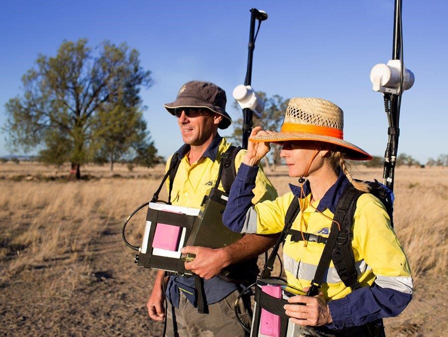
This study has built on the previous metallogenic study of Tate et al, 1987, supplemented with an exhaustive review of published company reports and communications, field inspection of 160 historical mines and mineral occurrences, collection of numerous observations and samples for radiometric dating, rock identification and studies of hydrothermal alteration, quartz textures and multi-element geochemistry. The ultimate aim of the study is to improve the understanding of the various styles of mineralisation throughout the region and provide a comprehensive digital data set for referencing and to stimulate exploration.
Geology in the Georgetown region is dominated by Proterozoic age granitic and metamorphic rocks. These basement rocks have been intruded by three phases of intrusives in the Silurian, Permo-Carboniferous and Permian. A prominent north-south striking belt of Permo-Carboniferous felsic volcanics (Newcastle Range) lies within the study area. Most of the deposits researched and examined in the field were found to fall into one of three categories, Plutonic, Intrusion Related or Epithermal.
The Plutonic style deposits are Early Devonian in age and form a north-south trending corridor 35km wide and 140km long that incorporates the gold deposits of the three historical mining centres of Georgetown, Forsayth and Gilberton. The deposits are mainly shear-hosted lodes in east to south-east trending faults. At each of the three centres there is a distinct zonation outward from hypozonal to mesozonal and epizonal level of emplacement and geochemically from Bi-Te to Pb-Zn-Cu to As-Sb. This is interpreted as syn- to late-deformational mineralisation localised in active structures above stocks that emanate from an underlying Silurian – Early Devonian batholith.
The Intrusion-Related deposits have Early Permian and Early Carboniferous groups with two possible Late Carboniferous examples (Mt Turner, Log Creek). All the deposits are polymetallic with prominent Te-Bi and As-Sb signatures. The Early Carboniferous deposits in the Kidston region are Au-rich mesozonal hydrothermal breccias whereas the deposits west of Georgetown are Early Permian-Late Carboniferous Au>Ag lode deposits (Electric light, Cumberland Mine, Beverley, Double Z) or Ag>Au epizonal-mesozonal lodes, stockworks and breccia deposits (Ironhurst, Phyllis May, Mt Turner, Bald Mountain).
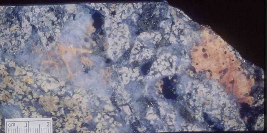
All the Epithermal deposits have rhyolites related to or of the same age as mineralisation so the boundary between epithermal per se and intrusion related epizonal is not clear. This separation is currently based on presence of chalcedony and boiling textures in Epithermal versus fine comb quartz only in Intrusion-related epizonal deposits, but both types have similar chemistry with significant tellurium and silver often greater than gold.
The mineral deposits of the Georgetown region were divided into 55 camps based on a common origin. Understanding of the camp features, timing relationships and zoning patterns produces a model of the mineralised hydrothermal system that allows prediction of favourable mineralised sites and an evaluation of the exploration potential. Although the Georgetown, Forsayth and Gilberton regions host numerous deposits covering a range of mineralisation styles, the region has still suffered from a lack of modern, focussed and thorough exploration. Detailed studies around existing deposits aimed at understanding the metal zonation, structural controls on shoots and metallurgical studies on sulphide ores aim to unlock new resources and advance the discovery of new deposits.


