Actual (top) Vs Modeled (bottom) High Resolution Ground Magnetic Survey 10m line spacing Gunnedah Basin Coal RTP
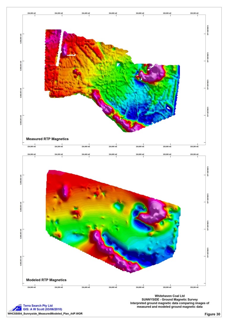
Actual (top) Vs Modeled (bottom) High Resolution Ground Magnetic Survey 10m line spacing Gunnedah Basin Coal RTP
Actual (top) Vs Modeled (bottom) High Resolution Ground Magnetic Survey 10m line spacing Gunnedah Basin Coal RTP